

Until recently, national grasslands were a mystery to me. But after an early June visit to Badlands National Park in South Dakota, we tacked on a hike in the adjacent Buffalo Gap National Grassland, and learned a lot in the process.
We intended to stop by the National Grasslands Visitor Center in the town of Wall for maps and information, only to find it closed for renovation. (The visitor center has since reopened as of July 2015.) A sign referred us to the ranger district office next door, where an enthusiastic, self-described “grasslands geek” answered our questions and provided the map we were hoping for. He seemed pleasantly surprised that we were actually there to inquire about the grasslands, as many visitors, based on the proximity to Badlands National Park, believe they’ve found the national park visitor center instead.
Here’s what we learned. The national grasslands are not national parks; they’re part of the U.S Forest Service so they’re like a national forest, which means they’re managed for multiple uses. There are actually 20 of them, scattered mostly in the Plains states, but there are also three west of the Rockies – in Idaho, Oregon and northeast California. However, only one visitor center serves them all; that’s the one in Wall.
 We asked about nearby hiking we could fit in that afternoon. Our grasslands expert unfolded the large Forest Service map on the counter and showed us where we could turn off the highway onto Forest Service road 7158, about five miles from where we stood. Although there’s a marker for the road on the highway, it’s easy to miss, so he told us to look for a farmhouse and some cell towers as landmarks. He explained that we could drive on the road and hike anywhere along it, adding that open site camping is permitted along roads that are completely within the grassland and not adjacent to private property.
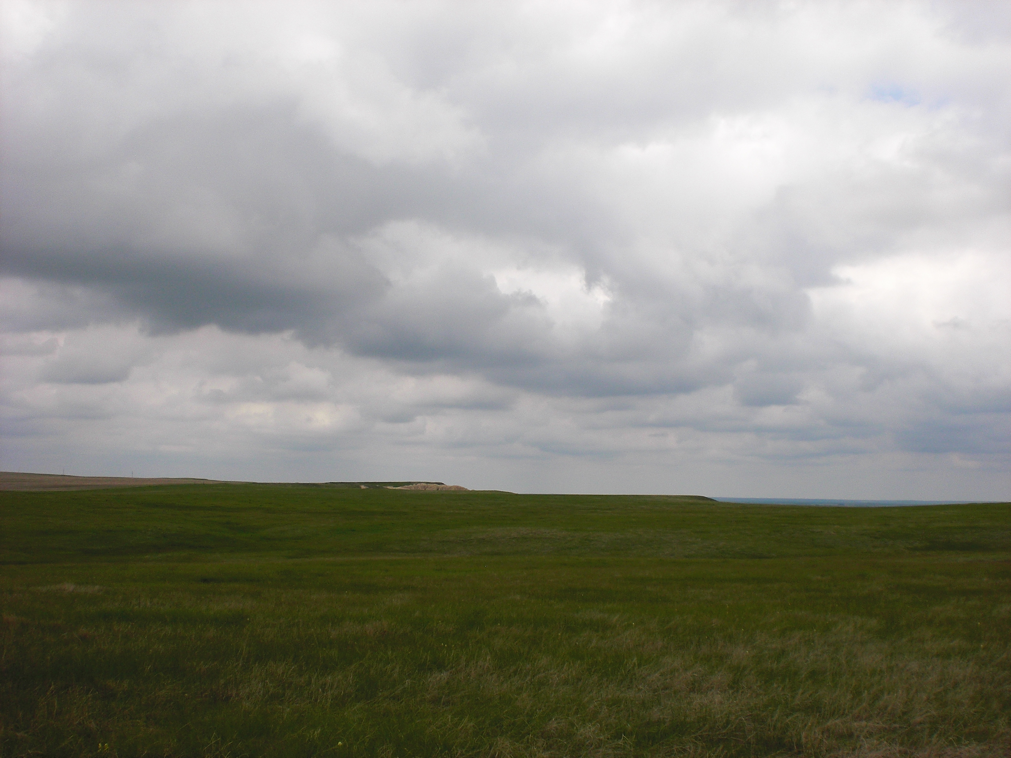
 We spied the marker for road 7158 and turned onto it. Basically, it’s a tire track path across the prairie; in places it was soaked from recent rains. Driving a short distance uphill, we parked, turning the car around to face downhill as suggested, in case another sudden downpour rendered the road too muddy to reverse course.
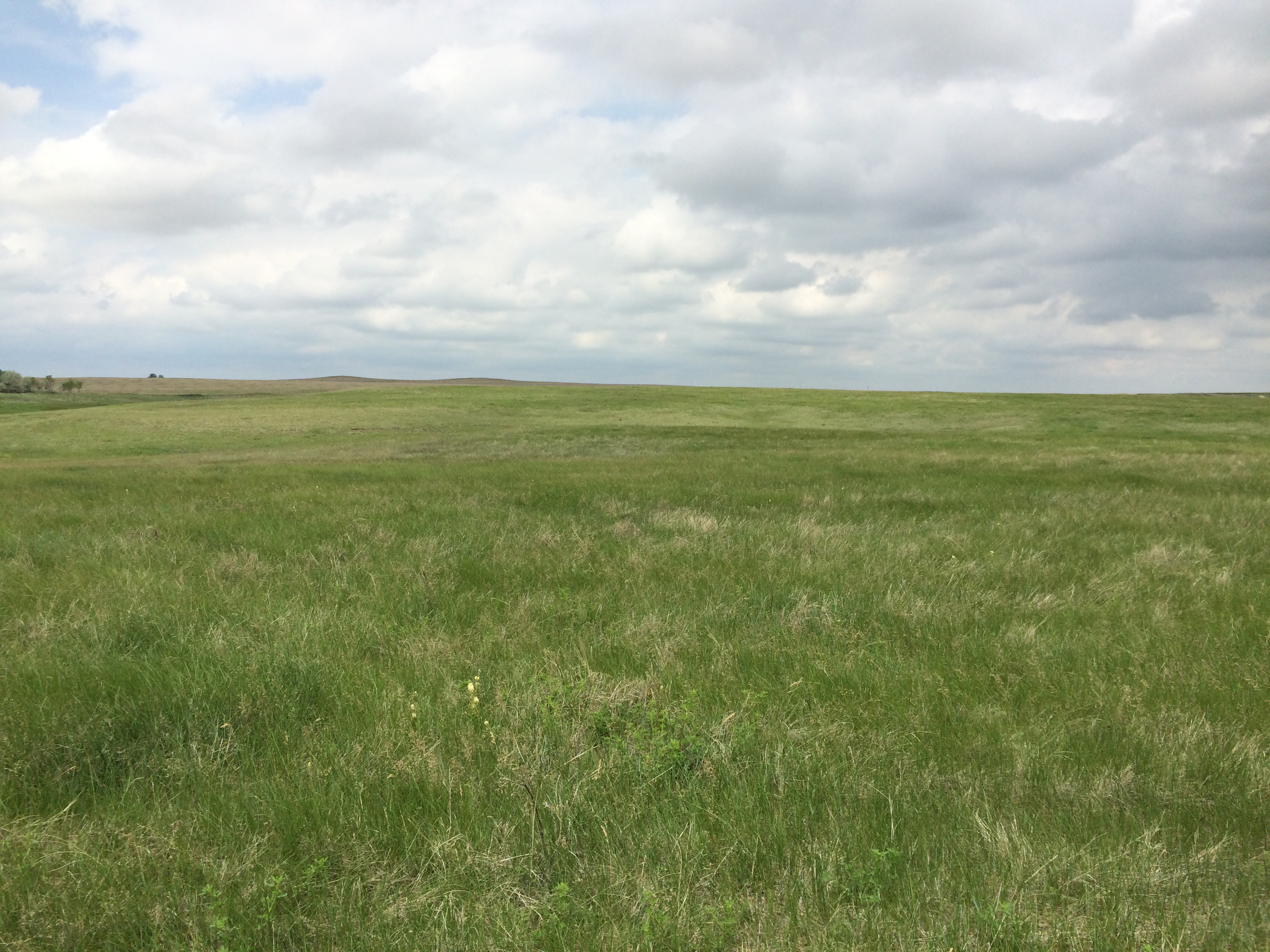
 We began hiking from there and I immediately noticed that the open, expansive character of the grassland made me feel small. It was hard to judge distance as we walked up the slow incline of the unchanging landscape. It was supremely quiet, but not without sounds. We heard an occasional songbird over the constant soft chirping of crickets, and always the whisper of wind blowing over the grass. Thunderstorms brewed in the distance.
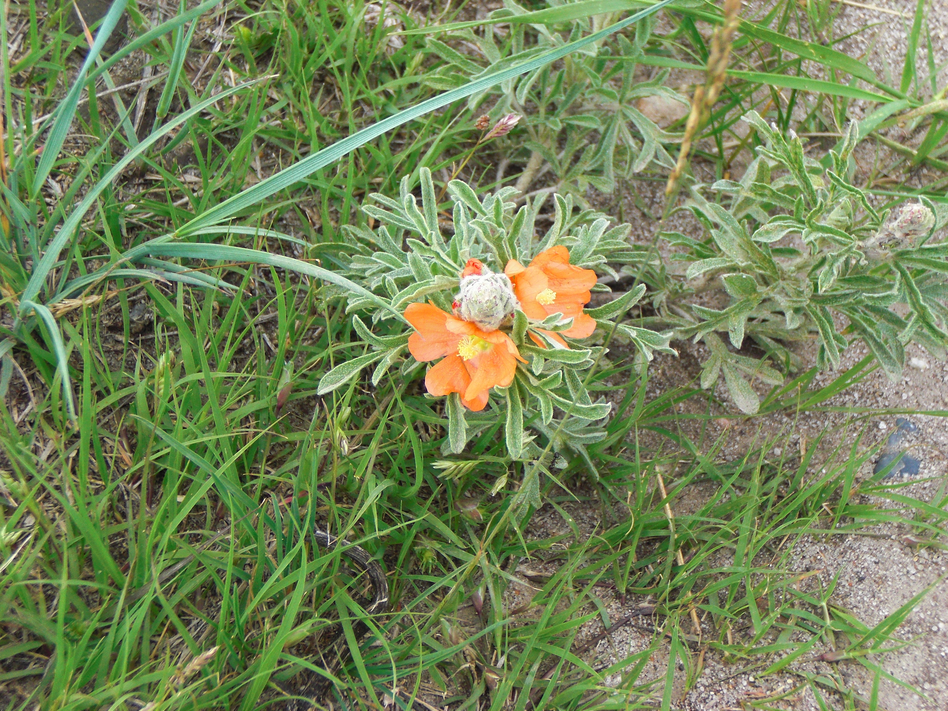
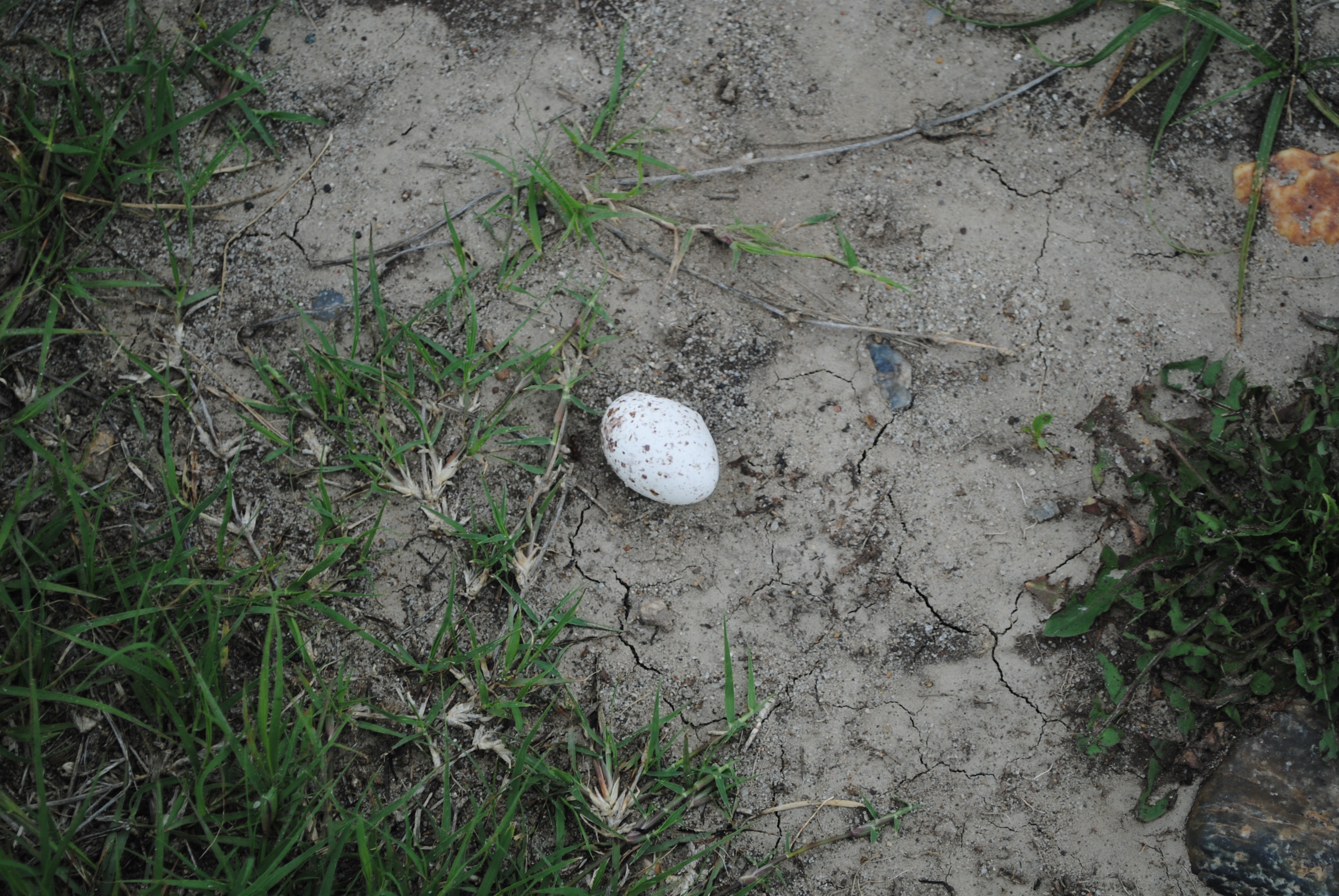
 Along the way we noticed occasional wildflowers, like orange-colored globe mallow. We also came across a spotted egg, about the size of a grape, in the middle of the road, thinking it was probably a snake egg.
While enjoying the mesmerizing solitude, I suddenly noticed the hundreds of mosquitoes that covered our clothing. While they weren’t really biting our skin, we decided it was time to head back. It was shortly after the turnaround point that we noticed the head of a snake in the process of emerging from its hole in the road as we stepped over it! Mildly curious about what kind of snake it was, we also knew there were rattlesnakes in the area, so we quickened our pace and kept on walking.
Our grasslands expert at the ranger station office had also explained how the national grasslands system originated – stemming from the federal government purchasing back land that had been granted and settled as a result of the Homestead Act of 1862. Settlers had been encouraged to replace the native grass with crops, but when drought caused crop failures and “dust bowls” from the plowed topsoil, and the Great Depression wreaked economic devastation, federal relief acts allowed the government to purchase the damaged land and begin repair.
 The former USDA Soil Conservation Service initially managed these land parcels, and in 1960, roughly one hundred years after the Homestead Act, the Forest Service began managing them to continue the long-term restoration process, provide a variety of recreation opportunities and oversee other uses of the land.
One of the other uses revolves around oil, gas and mineral extraction. We saw dramatic examples of that as we drove through another grassland later that afternoon.
Although we hadn’t planned to see two grasslands that day, we soon realized that our route from South Dakota to Casper, Wyoming took us right through immense Thunder Basin National Grassland. The landscape was dotted with oil and gas activity, and then we came upon Black Thunder Coal Mine, an enormous surface mine stretching for miles along the highway. Hundreds of rail cars on multiple trains were either loaded with coal or waiting to be loaded. Ominous orange signs on the highway warned travelers: “Blasting area. Orange cloud possible. Avoid contact.” It was eerie, and a stark contrast to where we had hiked a few hours earlier.
While we only saw miniscule portions of both grasslands that day, the differences in what we saw reinforced the varied nature of these lands. Two down, 18 to go.


Thanks for sharing you experiences. Grasslands fascinate me. I think of the settlers, especially the women, who found the landscape so lonely and depressing. But it is also so beautiful. Janet Fesler
LikeLike
Janet, Thank you for your comment. I’ve been fascinated by grasslands, too, so I was happy to have the opportunity to learn a little more about them.They truly are very beautiful. The terrain is so vast – I really did feel small walking through it. I was surprised to learn that there’s one in California and I’m curious about it.
LikeLike